At StatMap Ltd, we are committed to keeping our users informed and empowered with the latest advancements in our suite of products. We are excited to announce the launch of StatMap Insights, a dedicated section on our website featuring videos and blog posts about new features and updates across all our offerings.

Earthlight: Gradient to fill
Gradient to fill automatically creates a visual display representing multiple values through smooth colour transitions.

Earthlight: Adding Grid Layers
Adding a layer type called Grid Layer to your map, allows you to display the grid squares with their associated eastings and northings coordinates.

Earthlight: Flows - GeoTalk
Allows admin users to create an interactive document that works side by side with their map.

Earthlight: Temporary Layers
Allows admin users to import a gis layer to check the contents, before deciding whether to save it to the database.
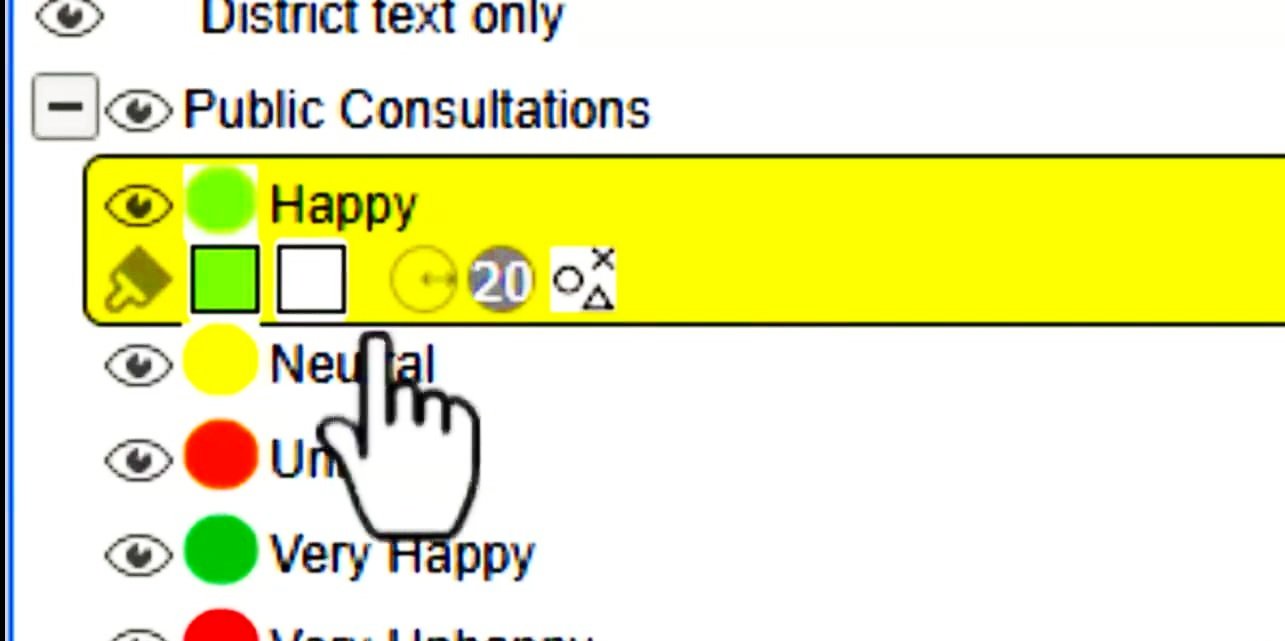
Earthlight: Dynamic Legend
Easy access to the styling of the layer, rather than via properties>display query>palette etc.

Earthlight: Flows - Redirect
Standalone task, if a website needs to be linked to via ELP map. Ie. Local Plan website, linked from the map.

Earthlight: Flows - Send Email
Allows information captured in the add records tools to be presented in Email format to specific officers, via email.

Earthlight: Inset Maps
Allows the display of various scale maps within the same print layout. The main map, plus more than one inset map, at different scales.

Public Planning Portal: Weekly List
Weekly Lists are produced each Monday listing all applications registered the previous week. These can be searched for be entering data parameters, or to display all lists, just click find and leave parameters empty.
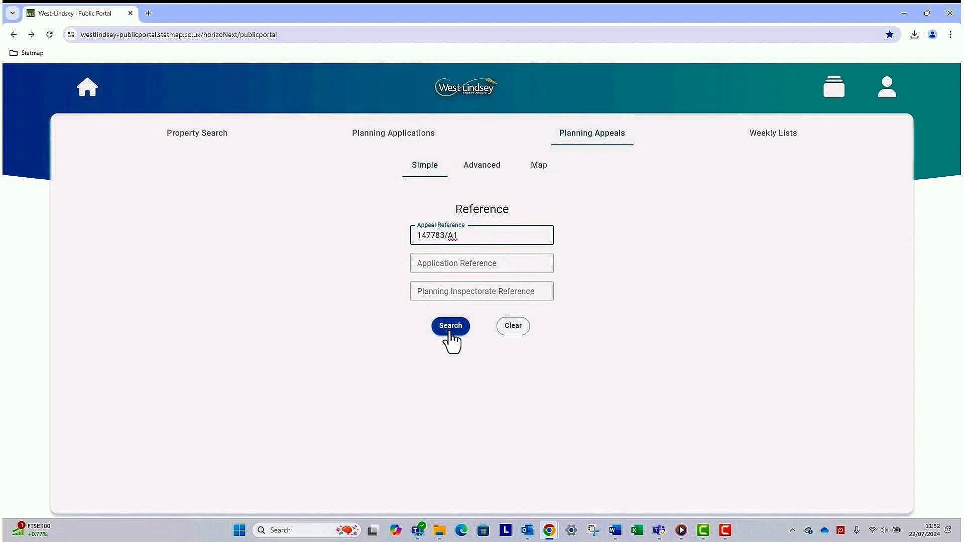
Public Planning Portal: Planning Appeals
Planning appeals can be searched for using the appeal reference number and will display limited information related to the appeal.

Public Planning Portal: Planning Applications
Planning applications can be searched for by specific planning references. Other parameters can also be searched under the advanced tab. Map searching is possible on each search type.

Public Planning Portal: Property Search
Applications can be searched for by specific addresses. If an account has been created this can be saved as a favourite search parameter.

Public Planning Portal: Creating an Account
Creating an account allows you to save relevant searches, and make comments on planning applications. Online comments can only be submitted from someone with an account, and these will then directly drop into the relevant application.

Earthlight: Revision Dates
The Review tool is particularly useful to ensure visibility of the current status of the datasets and whether they are static or receive regular updated versions.

GMS: Shield - Batch Updates
A validation tool which identifies updated data on several records at a time to ensure the integrity is maintained, and no "rules" are broken whilst editing.

GMS: Shield - Adding Record
A validation tool which identifies missing data whilst capturing a new LLPG record. Ensures the data integrity before Hub submissions happen.

Earthlight: Account Expiry
Increase security by disabling a user’s account the user hasn’t logged on in a set period of days/weeks.

Earthlight: Tooltip
Utilising Expression Tooltip to display certain data as a label when the record is inspected.
Earthlight: Flows - Drill Down
Easy way to interrogate certain datasets without running manual queries.

Earthlight: Flows - Instant Add Record
Easy way to add new records to a specific dataset without needing to use the normal editing tools. Ideal for first time users.